 N環球

Severe thunderstorms sweep Sydney on Sunday: NSW records 445,000+ lightning strikes, gusts to 113 km/h
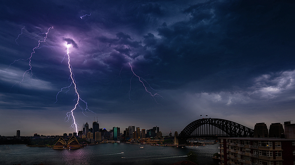
A 1,500-kilometre line of severe thunderstorms moved west to east across New South Wales on October 25, reaching Sydney's far western suburbs before 5 p.m., with the Bureau of Meteorology issuing a severe thunderstorm warning for the Sydney Basin; by 6 p.m. AEDT more than 445,000 lightning strikes had been recorded statewide, with a gust of 113 km/h at Cabramurra.
Why it matters
This was not an ordinary afternoon shower but a storm line stretching across the whole state, and Sydney was caught in it on Sunday afternoon. For anyone out on Sunday evening or travelling on Monday, the key points are: Sydney's detailed warning was cancelled in the evening, but warnings remain for other parts of New South Wales, and Monday's risk shifts to the northeast.
Full report
According to Weatherzone, a line of severe thunderstorms about 1,500 kilometres long moved from west to east across New South Wales on October 25, generating damaging wind gusts: 113 km/h at Cabramurra, 100 km/h at West Wyalong, 94 km/h at Narrandera Airport, 91 km/h at Wilcannia Airport, and 85 km/h at Nowra and White Cliffs. As of 6 p.m. AEDT, more than 445,000 lightning strikes had been recorded across the state.
The storms reached Sydney's far western suburbs just before 5 p.m. on Sunday afternoon, with the Bureau of Meteorology issuing severe thunderstorm warnings for the Sydney Basin, including a detailed warning issued at 4:51 p.m. for the Blue Mountains/Hawkesbury and Sydney areas. Within 50 kilometres of Bankstown, more than 1,200 lightning strikes had been recorded by 6 p.m., and Camden Airport recorded an 82 km/h gust as the storms rolled over.
The Bureau cancelled the detailed warning for the Gosford/Wyong and Sydney areas at 7:06 p.m., saying severe thunderstorms were no longer affecting Sydney, Newcastle, Wollongong and surrounding areas; a more general severe thunderstorm warning remained current for the Southern Tablelands, South West Slopes, the Australian Capital Territory and several other New South Wales districts. The State Emergency Service advises people to keep clear of fallen power lines, creeks and storm drains, not to walk, ride or drive through flood water, and to ring 132 500 for emergency help in flood and storms.
Looking to Monday, the thunderstorm risk contracts to northeast New South Wales and Queensland as a gusty southerly change moves up the coast, most likely reaching Sydney just after sunrise; severe storms remain possible east of the ranges north of Port Macquarie, with damaging to destructive winds, hail and heavy rainfall.
💬 Comments
No comments yet. Be the first!